GPS Metadata

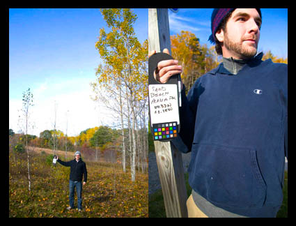
The digital r/evolution brings new habits. In my workshops we take GPS coordinates and location name (with my iPhone) and post them on a bulletin (along with a white balance target). Participants photograph the data at the beginning of each session/location. That way everyone has two pieces of useful information in one shot. It can be used for folder and file names and/or metadata.
I’ve been waiting to incorporate GPS data in my workflow until GPS is built right into my camera, but the inevitable hasn’t come as fast as I hoped for. If my cell phone has it built in, why doesn’t my 1DS Mark III? It’s probably time to buy a GPS attachment. Or should I go with a stand alone GPS unit that has a touch more accuracy and later sync the tracks? Either way, the message is just get started. The data’s too useful right now. And the longer I wait, the longer it will take to update all my old files.
Do you use GPS coordinates? What do you use? Comment here.
Check out my workshops here.

